|
rGaGEO has provided an easy to use interface management tool for digital maps and database records. rGaGEO Public Works Management products take advantage of the latest software and hardware technology in order to provide your Municipality with state of the art capabilities. rGaGEO Public Works was designed by rGa & Associates, Inc. with over 30 years of experience. We here at rGa & Associates thrive on using the most current and up to date geographical and topological technology available. |
|
Advantages to Using rGaGEO Public Works: If you’re a Bentley Microstation or ESRI user. Let our custom interface speed your current production two fold.
Precision and speed. Quality Control Connect the dot technology Construction Document Management
We don’t take care of the few, we handle the many! |
|
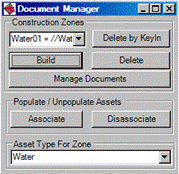
Construction Document Manager is a nifty tool allowing you to manage documents associated to assets. Not just one document but as many as you like! |
|
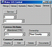
Services |

|
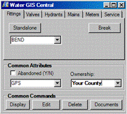
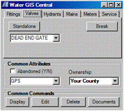
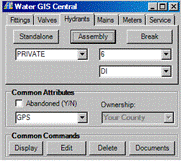
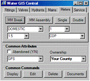
Water Mapping Tools |

|
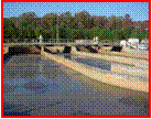
Storm Water |
|
Waste Water |